
Table of Contents for Part One
I. CCC & WPA
II. Not Stars
III. This is MO-133
IV. Humansville / West of The Lake
V. Sac-Osage
VI. I Don’t Know What It is About a Field
VII. Can I Use Dawn to Wash My Clothes?
VIII. Out of Gas, Into Soap
IX. Harrier Identification
X. Cattle, Cotton, Wind
I. CCC & WPA.
Still trying to figure out what those trees were. A couple possibilities: green ash, box elder. But I don’t buy either of them. Lately I have learned more about the scale of FDR’s shelterbelt project. There is a map that shows where the hundreds of millions of trees were planted. Landowners just had to agree to give up some acreage for tree planting. I think about my dad planting trees. I can’t say I’ve planted any. Cut a lot of them down. And they needed cutting down.
Two days ago I drove through what remains of the heart of the heart of FDR’s shelterbelt in south-central Kansas, USA. That tree-planting program might just have kept enough soil in place for there to be ranch land there today.
I’m flipping through The Audubon Society Field Guide to North American Trees. Eastern region. I’m going through every damn page. I’ve got the bark of this tree seared into my mind at 75 miles an hour. And I am grasping at straws.
Honey mesquite? Maybe, but mesquite’s a shrubby tree, it doesn’t get tall at all. Chokecherry? A reach at best. White mulberry, a variety thereof? Maybe. There’s smoke there. The bark I thought was reminiscent of Osage orange, a known relative of mulberry. Siberian Elm? The bark was not unlike elm bark but I don’t really know elms, them having been hit hard by Dutch Elm disease before I was even born.
There’s a tree called ‘Little Walnut’. It tends to branch near the ground. Its home is in Kansas, New Mexico, Texas. The Oklahoma panhandle isn’t specifically listed but it is implied. The Little Walnut matches the description well. White willow? Comprised of one to four trunks. Or maybe it was peachleaf willow? If only I had some leaves to go on!
I’m thinking back to being in Tucson and visiting Bookman’s, a used book store and “entertainment exchange”. I passed on a copy of the same brand of tree field guide—this one is from the library—but the one at Bookman’s was the “Western Edition”, for $6. I thought, No, I’m not going to need that—
II. Not Stars.
Moon
Satellites
Plane(t)s
Clouds
Nightbirds
138 passengers going
Through to Canada
But they didn’t even
Make Ukraine.
III. This is MO 133.
Richland, MO. Population 1,863. Pulaski County. I’m gettin there. There was more to this town, that I just saw, but I didn’t get a good look. Supermarket. Nice little park. High school. Dollar General. North on 133.
Crocker. Still Pulaski County. Hardware store and a small-engine repair shop. “We Rent Log Splitters.” Mile 1,440. 14:45. Lotsa fresh-cut trees lyin’ about. From here Route 17 splits off, runs north to Iberia. I stay on 133.
There’s a nice house. Cattle graze in low pasture. Eastern redcedars line the highway. They’ve been pared back. What does this region look like if cattle aren’t raised here? Wow, I’m over a hill, valley, lots of cows grazing. Open and contoured and beautiful. Due for a creek. Willard Quarry, woodpile, split ash.
Yellow–and-black horse-and-buggy sign. K & M Service Center. Dixon Saddle Club.
Two miles west of Dixon, hang a left to continue north on 133. Mailbox reading Yoakum 15420 Hwy 133. George? I know where I am now. 14:58. Sign for Maries County. Should I have taken BB when I saw it a while back? Cut thru? Is Dixon closer than Iberia?
Two dogs run out in front of me. Yikes. Labs. One black, one golden. Clean-looking. With collars. Probably radio. They duck under a fence. Goats! Bluebirds!
Highway DD. This is my turn. I haven’t seen a Miller County sign yet. House with junkyard. Hay in barn. Chimney pumping out smoke. Little Maries River. Hawk. Not a red-tail. The larger of Cooper/Sharp-shinned. Cow pond. Old barns. DD ends.
Left to Rinquelin or right to Farm. It is I believe a County Road, a dirt road, a little ways south of the notch. My mom painted this road, based on a photo of mine on a foggy morning leaving Farm party.
Back pasture, cow pond. Karmack’s cows in a Lee-Vaughan field. 49°. 1,463 miles, 15:14. Back drive, I almost overrun it, new gravel, cinder block sentry at the back door. I’m here.
IV. Humansville / West of The Lake / Route 7.
My unidentified tree is all but gone. I’ve never approached Farm from this direction before. I wasn’t sure we came this way on the way out but now I’m certain we did. I remember that collection of Trump flags, especially the pink “Women for Trump” flag.
The town of Collins. Shaggy hay bales. Horses. A sign indicating the turnoff for Route 13, to Humansville. Who names these towns? Fifty-three miles to Camdenton.
The number of creeks and rivers upticks in eastern Kansas and they’re common, frequent here in western Missouri. I’ve not even been listing all the ones I cross. For instance, I didn’t write down “Weaubleau Creek”. More hay bales, not as shaggy. This is Hickory County.
There are a few clouds out there, high cumulus. Cumulocirrus I think, if that’s an official classification. A great blue heron. A sign for fresh ground horseradish. Now the town of Weaubleau. ‘Weaubleau Pawn’, says a handwritten sign. Weaubleau Motel, little chic-shacks. Valleying. Walmart semi. Weaubleau Creek again!
Little Weaubleau Creek. My eyes are heavy, strained. Not surprising. All the looking up, looking down, looking back up. I had a plan once to use bifocals for this. I enjoy it anyway. It’s my form, it’s unusual. But, oh, to be out of this car for one full day.
A sign offers “BULLS” with a phone number. And an “L” in a circle. Another sign a little ways down, opposite side of the road, elaborating: “LUCAS RANCH BULLS”. A maple. Wheatland, MO. Where the governor was born. Another sign for Dick’s Horseradish, fresh ground.
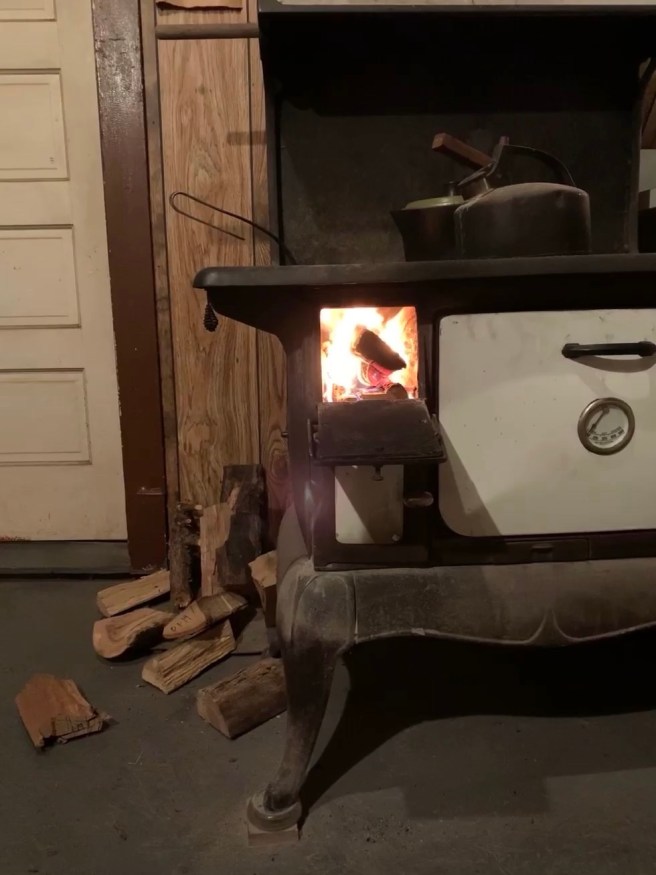
I’m gonna use the greasy Ziggy’s pizza cardboard to start a pile fire. It might’ve rained at Farm but there’s no sign of recent rain here. Hermitage, population 467. Dollar General, flea market, thrift store. A fifty-something guy with a long, grey-black beard. Hermitage Supermarket.
Pomme de Terre River. Sixty miles to Eldon. Coffee swig. These eyes. Bald eagle! Like a big old owl up in a tree, but bigger. Hugo-sized. How much do eagles weigh, anyway? I saw its form first, then the white head. They are a stately bird.
Preston, MO. Cowpond. Cowpond blue. Hang a right for Pomme de Terre State Park. Cedar Street. A blinking red. Four-way stop. I continue east on U.S. Highway 54. Red-tailed hawk. Grey smoke to the southeast.
I’ve been through Camdenton. West side of the lake? Or is it only the middle? Please advise. I can’t say I’ve got a feel for it. Now on Route 7 south. High Bros Lumber and Home Center. Mile 1,404. It’s probably not closer to Farm than the hardware stores of Rolla or Osage Beach. Lots of turns on this Route 7. Very Missouri.
Box Ranch. White fence. Turnoff for Hugo—the town, not the dog. He’s back there, but as usual he’s not saying much. Glaize Creek. I’ve got the BBC’s “NewsHour” on 91.3 KBIA out of Columbia, MO. There’s so much going on in the news the last few days, after the U.S. took out Iran’s general by drone in Baghdad. When I’ve been able to find public radio it’s given me something interesting to listen to.
The town of Montreal—Missouri. 14:12. There’s not much here. A Quick Stop. Some empty homes. E & M’s Whistle Stop. Curving, heading out of town, now a few well-kept homes. Rolling hills. Redcedars and oaks. Winding roads.
Traw Branch. Climb on smooth concrete highway. Vista. Hills. A nice house up on a hill. Garman Creek. A sign for Carroll Cave Road. Retention ponds. Maybe a fish farm. Route T to Stoutland. Pretty out here. Feels and looks like Farm. The road is good. No one behind me.
Sellars Creek. I don’t know any of these creeks. What might they feed? Climbing. Grazing cattle. Descent. Murphy Creek. Climbing again. A pattern emerges. A semi with “Vet Supply” written above the cab passes in the opposite direction.
In the front yard of someone’s house a large, gnarled lower-half of a cedar tree—the trunk and a rain-washed root ball—set out as yard art. Pretty cool. Beulah Baptist Church. A tanker truck—loading or offloading, that is the question—at a propane node.
V. Sac-Osage.
Missouri. Immediately an enormous collection of firewood, presumably on offer, out in front of a place flying a banner that says “Jake’s Fireworks”. I guess fireworks are not legal in Kansas.
I had stopped in Fort Scott, KS. Not a bad stop. I went to the G & W Foods. It’s a cost-plus store. You pay 10% over cost. I got bananas, carrots, lettuce, avocados, milk, a yellow pepper and two gallons of water. I also used the restroom. I’ve already eaten two carrots and a banana.
Then I took Hugo for a short walk. I liked the small-town feel. It was reminiscent of Okawville, IL where my mom’s parents lived when I was young. It’s really nice out! Fifty degrees, sunny, there’s only a little wind. I’ve got a Buster Olney baseball podcast going via phone. I had a feeling he’d drop a podcast today. Also, I got an email confirming my enrollment in a travel writing class.
There were ash trees and some kind of nut tree along the residential streets of Fort Scott. Not walnut. Pecan? I don’t think so. Hickory, I have a feeling. Not shagbark. Pignut? Mockernut? I don’t know. Yet.
Nevada—Missouri. Dollar General. Woods Supermarket. The I Don’t Care Burrito and Taco Shack. Cottey College. Houses with siding. New sidewalks. Domino’s, Family Video, McDonald’s. Osage Motor Service. A Marines recruitment office. Highway 54 snakes its way out of town. I’ll be on it for a while yet.
El Dorado Springs. It’s still cattle country but not quite ranchland. The agriculture operations at some point stopped identifying themselves as Ranches and instead as Farms. It’s gotten hilly. There are so many more trees. Horses. Now, a white fence. A mansion, an estate. A manicured, tree-lined driveway. A sign: Silverline Ranch. Well, so much for my “no more ranches” line of thinking.
But this white fence is new and unlike anything I saw between here and Arizona. I don’t quite understand what I’m looking at.
I’m seeing all these cedars along the road and I’m wondering. Does a warmer climate—a shorter winter—favor an evergreen like the eastern redcedar over and above the deciduous likes of oaks, hickories, and ashes? Can the cedar continue to grow—can it continue to communicate with its fellow trees underground during warm, winter stretches when the leafless trees cannot? Is this what makes the eastern redcedar a newly invasive, extra-competitive species, even though it’s been here for two hundred years? Or is its rise in these parts coincident simply with the man-made lack of fire?
Sac River. A beauty! It had current, surface action, width. It’s nice here. Not bad at all. Tractor parked in a driveway with a brush hog attached at its back, a bucket turned upside down and placed on top of the smokestack up front.
VI. I Don’t Know What It is About a Field.

In eastern Butler County the fields opened up, took on the wispy gold of uncut hay. Not long after that hills appeared. I could see the outcome of geological events, the hint of a rock facade where the road cut through. But the grass didn’t mind the hills and it ran long and uncut up and down the slopes still. A valley appeared, a vantage, a vista. I thought of a scene from Dances With Wolves where they creep up to a crest and look down to see a herd of buffalo grazing in peace.
It would’ve been a good place to stop but I was going 75 and I was only an hour into the drive. It’s a spot to think about, for another. A spot worth reaching over into the glove compartment and pulling out this notebook for, this emergency notebook, never been written in before, the two notebooks I did happen to bring being secure in my bag.
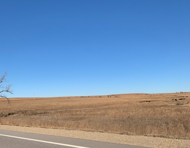
I’m east of Wichita, KS on U.S. Highway 54, where Butler County ends and Greenwood County begins. Hay, cow ponds, the cattle dark against the golden light of the field, dark against the blue of the sky, against the shapely hills.
FDR had some sort of windbreak tree-planting program. A shelterbelt. I never gave much thought to windbreaks, to trees as a line against the wind. This tree I keep seeing, that is so prevalent, must have been one of the trees of choice for the shelterbelt planting. It’s often got a lopsided crown and most of the time its trunk splits into two not far from the ground, a couple of feet up, maybe less. This tree, whatever it is, is not at Farm. It’s a Dust Bowl thing. Kansas, the Oklahoma panhandle, the upper Texas panhandle, northeastern New Mexico.
Verdigris River. Huge collection of trees. Oak and sycamore appear, maybe even ash and walnut. Through a roadcut where the bedrock is visible. Suggests the soil isn’t deep here. I guess that’s why there isn’t much crop farming.
Ranch hands in the near corner of a field, close to the road. Slowed to pull into the drive there so I could go back for a photo but it’d be weird if I pulled in with them there, even if only to turn around. Definitely more oak now. A few of what I believe are white oak, which are not altogether unlike that mystery tree. The color of the barks is similar and the crowns are not dissimilar but the white oaks are not split at their base. Rather they have a cylindrical, straight trunk that could pass as a post until you get about ten or fifteen feet up, where branches then begin to head in various directions.
The would-be photo was of an old, dilapidated, headless windmill set back about thirty feet from the highway with an old, brokedown shed or barn another twenty or thirty feet behind it. Could some of these old, abandoned structures have been empty since the Depression? The history of these tracts is starting to seep into my mind, starting to get me interested.
Possible harrier sighting. Allowed only a top-view it is hard to distinguish a harrier from a red-tailed hawk but I am learning that the harrier profile is more aerodynamic, its lines are sharper. Pretty bird.
Yates Center. Still a working town. Several gas stations. Auto parts. General stores. A G & W Foods. As quickly as it appears the town falls away again.
In situ woodpile where field meets woods. Newly sawed logs on top, their end-faces wood-bright, the logs below them dark with time and season. Still good? Can’t leave it there too long. But that’s the first woodpile I can remember seeing since roundabout Mountainair, NM where beside a house was a pile of firewood that looked like it had been dumped from the back of a truck. Splat.
There are so many more trees now, trees with rust-dry leaves still on their limbs—oak. Post or red or black. Woodpile outside a house. At least three different kinds of wood, well-stacked. One stick was light, whitish. Another orange-reddish, fox-red. Cornfield. The trees, the corn. The soil must be better now. How quickly the landscape changes.
Neosho River. Iola. Another G & W Foods, this building new, the brick a handsome dark red. I don’t stop but if I see another G & W, in the next town, I’ll go in and get some veggies.
The town of Gas. Funny name. A business called “Roxanna Pipeline“. Out in a fenced area beside their building were several of those oil pump, teeter-totter things that crank up and down on one end, with a wheel spinning or turning over at the other end. I don’t know what those mechanisms are called. I always thought they were involved in oil drilling but it never quite made sense because they’d be out in the middle of a field planted with crops, corn or beans. Could they instead be part of some pipeline infrastructure? Look it up!
VII. Can I Use Dawn to Wash My Clothes?
Research says yes so I am trying it out. Caveat: you don’t need to use nearly as much dish soap as you would laundry detergent. Or else, supposedly, the washing machine will overflow with bubbles. It’s $2.25 for the cycle. Nine quarters. I had that many and then some in my old backpack up here on the second floor of a La Quinta Inn & Suites in Wichita, KS.
It’s been awhile since I’ve done laundry while traveling. The laundry I recently did at my in-laws in Arizona doesn’t count. I’m talking about pay laundry. I forgot about packing some laundry detergent. I usually carry a good handful of quarters but I’m lucky to’ve had as many as I do. A sack of quarters in the camp kit along with a travel-bottle of laundry soap is a good idea whence on a trip like this one.
Hugo is giving me stink eye. It wasn’t the most interesting day for him, though we have gone on three separate walks, totaling at least forty-five minutes. I’ll get him out again now so it will be done and I can focus on other things, such as: shower, laundry, writing, pack prep.
You know what else I wish I had brought? An old Altoids tin or similar container in which to have collected all the partially used soaps we’ve used over the course of being in and out of—now—six different hotel rooms.
What I do have is a nice desk at which to sit and write in this ‘suite’ at La Quinta Wichita East. The suite was only $10 more than the regular one-king room. It’s worth it. Henceforth, I will always opt for a suite if it’s available, and if the price discrepancy isn’t wild. The extra space is nice, sure. Especially if it’s me, B, and Hugo in the room. But it’s more than that. Here, for instance, Hugo gets a couch to lounge on, a sort of chaisse-sectional. He likes it. I sat there a bit with him. He hopped up on it right after we got into the room. I’ve since put a towel down so it’s between him and the fabric.
I also get this desk, which wasn’t in the one-king room in this same hotel when we stayed here a little over a week ago on our way to Tucson. There are more lamps in this room, too. Further, I have never known a suite to have along one of its walls that doorway that can open and allow you to go into the room next door (assuming, of course, that the inhabitants of that room also open their adjoining door). The problem with this additional doorway is that it can allow a lot more next-door noise into your room.
We had opted for a suite at the Drury in Las Cruces on our way to Tucson. One of the extra features in that suite was the wet bar, which gives the room an additional sink, one that isn’t off-limits if your hotel-mate is in the bathroom. This can be important at teeth-brushing time. Also in the Drury suite but not in the Drury standard room: a real, adult refrigerator. None of that mini-fridge nonsense, with their faux-freezer compartments. In a real freezer we can get our fake ice-packs nice and cold to keep the cooler cold well into the next day’s drive. These little perks make a big difference when you’re driving over a thousand miles, checking into and out of different hotels day-after-day. Finally, it also seems to me that a suite has a deeper footprint than a regular room, which means you can get further away from the noise of the hallway, if desired.
VIII. Out of Gas, Into Soap.
I’m flagging. It’s 22:34. Today was a slog. A grind. I made one bad, bullheaded, rather flippant move, which was to push the gas tank as close to empty as I’ve ever done, in the Subaru at least.
I’ve gotten a better feel for the Subaru tank, and for the estimate the car’s computer gives as to miles ’til empty. The gas light goes on at about 60 miles ’til empty. I had it there yesterday south of Tucumcari, NM when I was hunting magic hour photos amongst the mesas and chollas and mini-canyons.
This morning I filled it with 16.13 gallons at the Shell station within a stone’s throw of the Tucumcari Best Western/Discovery Inn. Incidentally, I’ve been on a premium gas kick. Is this justified? In any way? Less ethanol? And by the way, I have never before this trip encountered so few gas pump kiosks able to issue a paper receipt. I have gone into four gas stations, across several states, looking for a paper receipt. Are gas stations just giving up on issuing receipts outside?
Anyway. I pushed the gas tank yesterday. I figured: if the listed capacity of the tank is 18 gallons; and if the gas light comes on when I am able to fill it with only 16 gallons of fresh fuel… then even with the gas light on I can probably still drive for fifty or sixty miles, regardless of what the computer’s estimate is telling me. I rested on this line of thinking, something I wouldn’t usually do.
It backfired today. When I finally got off of U.S. 54 and got into Wichita, my maps app had me take I-135 to KS 96 to Greenwich Road, where the hotel lay. I figured I’d see a gas station along Greenwich Road, God knows there is one of just about everything else along there: fast-casual restaurant chains, a bevy of hotels, fake-chic stores, Starbucks, McDonalds, big boxes, everything! Cabela’s, Menards, Duluth Trading, Dave and Busters, Michael’s, Ross, you name it!
Once I exited KS 96 I first headed in the direction of the hotel thinking I’d see a gas station somewhere right around there. The Subaru’s mileage-until-empty estimator was telling me I had thirty miles ’til empty. I passed the turnoff to the hotel without seeing a gas station. I was a little irked and I didn’t want to continue driving in a direction I’d never gone so I busted a brusque U-E outside some cross-fit gym. Doing this for some reason resulted in the car’s computer mileage-til-empty estimator conking out, leaving no number displayed at all.
Now I was heading back in the opposite direction down busy Greenwich Road. I remembered seeing a gas station on a corner down that way when we went to Starbucks the morning we drove west out of Wichita. But when I went down that way today I realized with horror that it wasn’t a gas station there but instead a McDonald’s!
I was starting to panic a little bit so I pulled into a big shared parking lot for some of the big-boxes. It didn’t help that I also really had to go to the bathroom. I opened up my maps app and found the nearest station, and it wasn’t far away but I was all turned around. The maps app voice was telling me to do this and do that and I was yelling back at it, probably freaking Hugo out. It was all pretty ridiculous. Finally, I figured out I needed to take a right onto Greenwich out of the parking lot, then a left on 21st Street to find a Quik Trip that was down that way.
Disaster averted, I put 16.79 gallons in the tank and went inside to use the restroom. Two young boys were in there messing around at the sink. I couldn’t help but listen to them as I used a urinal. One of the kids—I think they were brothers—was really interested in the soap. I could hear them banging away at the soap dispensers.
“Smell it,” one of them says. “It smells really good.”
No response.
“It smells like suckers,” he continues. “And it’s pink. Look. Like cotton candy.”
“I’m not gonna taste that soap,” says his brother.
When I was ready to wash my hands I headed toward the sink, which had room for two people at the most. One of the kids then left the restroom. His brother remained. He was hunched over the sink with his hands cupped. In his hands was a massive pool of the pink soap. He was putting his face down toward his cupped hands, taking sniffs of the soap.
He looks over at me and says, “This soap smells really good.”
This kid was six or seven years old. Inside I’m just shaking my head in a what’ll-they-think-of-next sort of way. I’m also wondering where one of these kids’ parents is at. I tried to play along.
“That’s good,” I said, “not all soap smells good.”
That’s all I had. I don’t even know what I meant by that. I got a shred of paper towel and used it to open the door and left. He came out not long after me and joined his brother at the counter. There wasn’t anyone in the store that struck me as being these kids’ parent. But outside I walked past a big SUV parked right in front of the store, in which a woman was talking on a cell phone. It might have been a serious conversation. I felt for that kid then. He just wanted to talk about soap, turned loose in a QT by a mom who had problems to deal with or who just had no better idea than to take her kids to QT and tell them to go explore the convenience store.
Driving back to the hotel, once again down busy Greenwich, I saw a group of four or five people situated on the sidewalk beside the road. There were two people down on the ground. I got a look at one of them, a teenager or a twenty-something who appeared to be knocked out or barely conscious with her hands to her head, laid out flat, face down. One of the people standing over her was talking excitedly on her cell phone, presumably with a 9-1-1 dispatcher. I could not glean any more idea about what might have happened. There wasn’t any vehicle up on the curb, or stopped along the road anywhere nearby. Fallout of a fight? An overdose? It was bizarre. I didn’t figure I could help in any way; I just wanted to get into my hotel. Which mere minutes later, I accomplished.
IX. Harrier Identification.
OK, now: that tree. And: that bird. But wouldn’t you know it? I stuck the tree field guide in the cardboard box, the one I designated to hold those items I was pretty sure I wasn’t going to need on the drive back, at least not until I got to Farm and I could exhale. Alas, alackaday, amor.
The bird then. I’ll just punch the field marks into my phone’s Merlin bird app and let’s see what returns. Harrier! Wow. I can recall thinking I saw one once, just once. At or near the confluence of the mighty Missouri and Mississippi Rivers. But now, yes, they are prevalent on that drive along U.S. 54 from New Mexico to Kansas.
What struck me first was: white rump. Not a small bird at all, a big bird. But not eagle big. Yet, that white rump stood out. If not an eagle, then… what? Second field mark: the bird showed its underside readily. And while its topside was indistinct—would I call it grey? grey-brown? mottled?—the wings underneath were unforgettable: black wing tips. With the rest of the underside of the wing being pretty white. Also, the flight: the wings were sharp and kinked, such that the front wing of the bird made more of a “w”, almost like the constellation Cassiopeia. The bird banks a lot, makes turns, tips. It’s not really a hovering bird like the kestrel falcon but rather an air-schmoozer. It is out on the hunt, checking everything out. I saw a bunch of them. I saw them all day and now I know: harriers! Though it should be said: only the male has the distinct under-wing markings. The female harrier is going to be a lot harder to distinguish from a red-tailed hawk on color alone.
X. Cattle, Cotton, Wind.
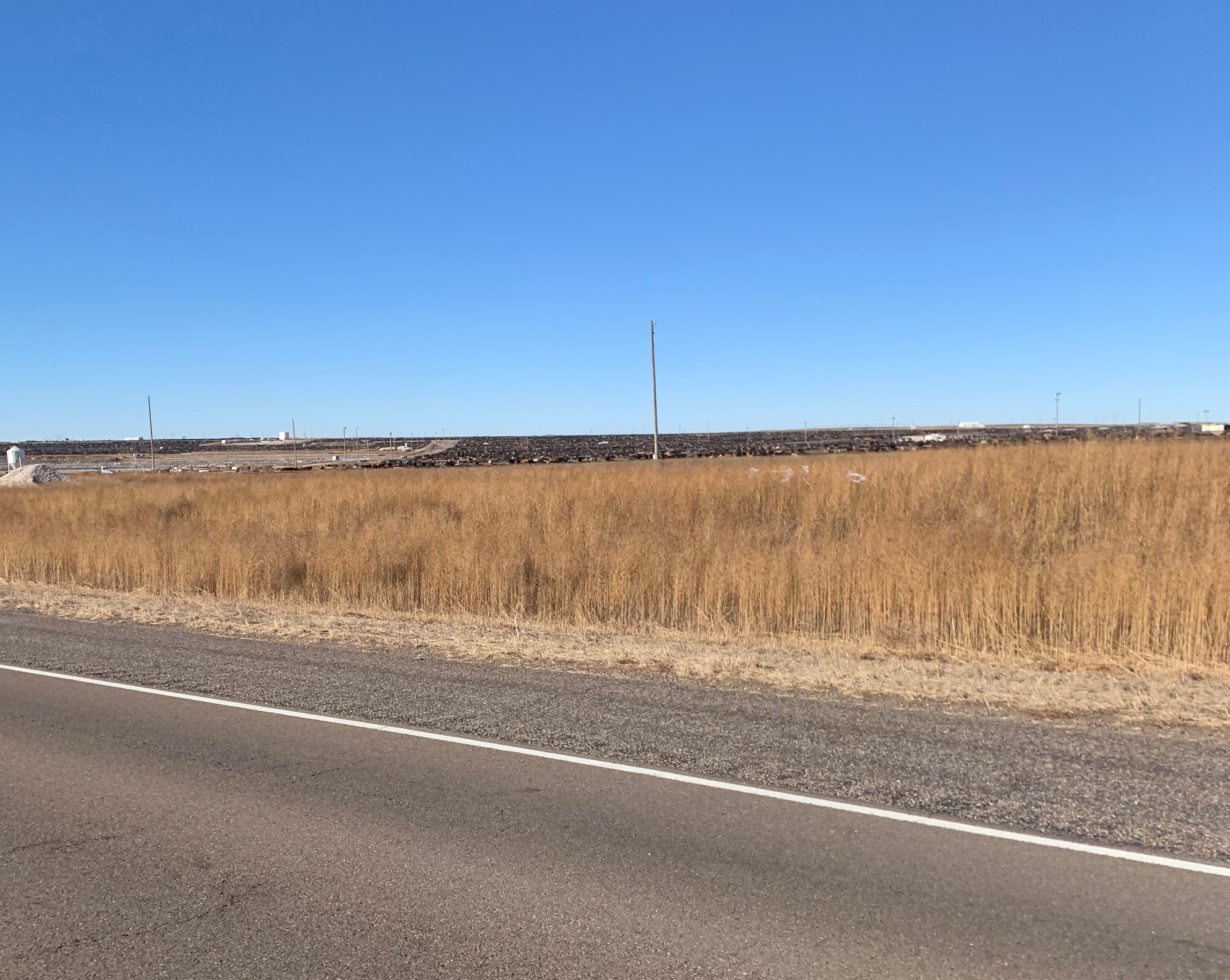
Feeder lot. Cows and cows. A little bit of smell but not like you’d think. Oh, those cows. Thousands. How quickly do we eat through that? Now another feeder lot, other side of the highway. I just took some out-the-window shots but they were terrible, thanks for asking. They don’t come close to telling the story.
I keep seeing the acronym “XIT”. Or is it a name, a moniker for this particular area? How does anyone ever keep track of any of the cows in these places?
Road work. Shoulder grading. Rock-dumping trucks. Elevator on the horizon, cast in cement. Dalhart, TX, population 7,930. No more are there indications of elevation for the cities you enter. A gas station called Toot ‘n Tootum. A grocery store called ShopKo that is very out of business. Where are people getting their groceries?
This is right about the piece of road where, when we were driving in the opposite direction, toward Tucumcari, we got hit with hail, which collected on the highway surface as a mess of slush, and I skidded just a bit. The eastbound lane now goes two-wide for awhile. That’s the nice thing about U.S. 54—relief lanes. Passing lanes, sprinkled in, on both sides of the highway, every ten miles or so.
A second fantasy baseball podcast concludes. I’m an hour and forty minutes into the drive. A little bored, reason in part why I write (this). I’ve had very little coffee. Abandoned house.
Meadowlarks. Dang! I realize now that I’ve just lost an hour. Mountain to central.
I need to jog at least a couple of miles when I get to the hotel in Wichita. And I gotta get that pizza. Next passing lane? Six miles. Utility lines run along both sides of 54. One line runs on wooden poles. The other poles are taller, metal, two-legged. Heavier-duty carriers. No trunk lines running off them.
Getting groggy, feeling sloggy. It’s very windy. I’m still in Texas but close to the border, close to Texhoma. Cotton hot-spot. Cotton fields have a rust-red stubble, with cotton like snow visible as a dusting between the rows, or still stuck to the tops of the red-brown stubble. Texhoma, population 346.
There are still ranches around but cornfields exist here, too. No more cholla cacti. Elevator town. ‘Texhoma Wheat Growers, Inc.’ is painted on one of several elevators. Blinking red. A couple of gas stations. There’s the Love’s we stopped at on the way out. Cotton field. Irrigation company storefront. Water Right is the name. Wind turbines. U.S. 54 east goes double-wide. I’m making my move, past a cattle truck. The wind!
Small feeder lot. Railroad tracks alongside the highway on a raised bed. The highway curves and I’m tussling with the wind at 80 miles an hour. Train! A Union Pacific double-stack. It’s noon, central standard. I’m-a see if I can’t find some news.

To Be Continued…
Discover more from JBR.com
Subscribe to get the latest posts sent to your email.
