
Table of Contents for The Second of Two Parts
I. Aermotor
II. The Golden Globe
III. Taiban to Quay: A Photo Essay
IV. Billy the Kid Grave, Two Miles
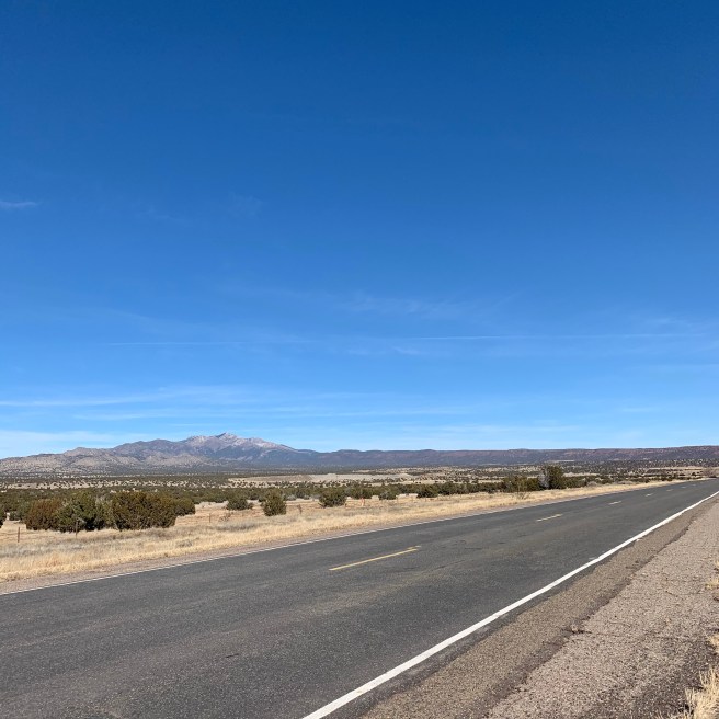
V. New Mexico, 60 East
VI. Wind Gusts Possible
VII. Interstate Love Song
VIII. Pistachios, Probably
IX. What Is A Canyon, Anyway?
X. The Trail Less Traveled
I. Aermotor.
Left Tucumcari, New Mexico at 8:40. The woman at the Best Western when I checked out says, “You look like you could use more sleep.” Oh, thanks! What a nice thing for you to say. Yeah, I could have used some more sleep. But other guests stirring early, doors clanging, and then someone freaking out when a cat jumped out of the hallway trash can meant it was time for me to get out of bed. That and needing to drive another eight hours today.
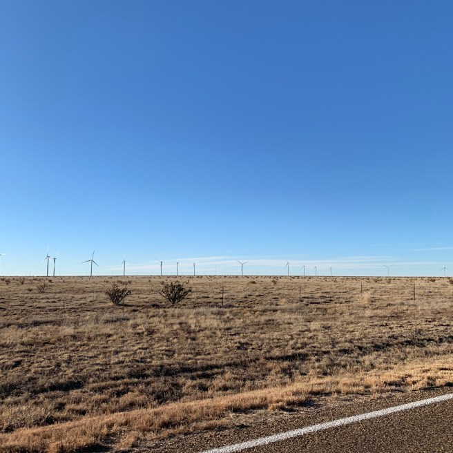
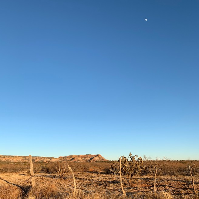
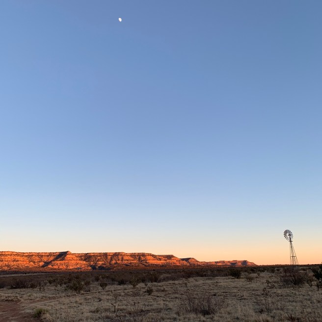
I’m on U.S. Highway 54 headed east. This highway takes me all the way to Wichita. Land is mostly flat. Ranch land. Cattle grazing. Mesas in the distance, to the west. Lots of Aermotors. I’ve realized that’s a trademarked name for the old-style windmills.
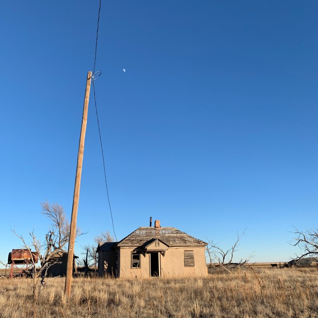
Lots of empty buildings here. There were lots of them in Tucumcari, too. That town is hollowed out. Abandoned homes. I suppose Tucumcari had its day. Post World War II. Car culture. Route 66. Before passenger air travel proliferated.

Geese! A string of 20. Canadas. Seven more. Eight more. Another twenty. Flying low-enough to where I can identify them with confidence.
We came through here nine days ago but we couldn’t see anything because of rain and fog. So this is all new to me. Railroad tracks run parallel. Utility poles, power and phone. Sun through the passenger window is strong. Big crow—a raven?
I don’t have much New Mexico left. I’m going to miss this terrain. There is a Ute Lake State Park not far from here. Canadian River. New bridge being built. Wide crevasse. Big project.
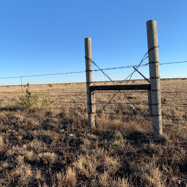
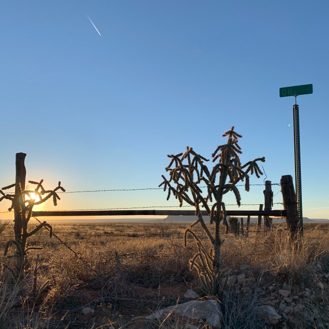
Logan. A market, a couple of gas stations. Sheds for sale. Crossroads Cafe. Twenty-nine miles to the state line. Trip-back odometer: 723.8. I don’t see the cholla anymore. Ope, there’s some. But it’s phasing out, right around here. Palla’s Shoenail Ranch. Shoenail? An Aermotor rippin’ in the wind. Not a cloud in the sky. It is very windy, the breeze is knocking me out of true.
Semis predominate. Pickups, often with trailer. I’m the outlier in this Outback. I’m behind a semi and have been, at 67 miles per hour. Headed opposite: pickup, pickup, Mustang, pick-up with trailer, Fed-Ex double cargo.
Yuccas. Greasewood. Sage grass, green with a white crystal sheen. Then a rust-red grass starts in. I did see cotton on the edge of New Mexico 209 last evening as I was messing around trying to get quintessential late-light photos. So somewhere just south of Tucumcari there is at least one cotton field.
Semi after semi. Forty minutes into this drive already. I’ve only had one vehicle behind me, a souped-up utility-grade pickup that eagerly passed me, and I was glad of it.
Aaaaaand…. I’m in Texas. How did that happen? Shiny silo. First real sign of grain ag in a while. Could just be feed. Coots Ranch. A little hilly. Small hills. Mounds. Hummocks. The occasional tree. Aermotor. Cow pond. Railroad closet. Not sure what to call those. A little booth next to the railroad tracks. Five feet high? A faded ranch sign. Hugo stirs in the back. Line of geese in the distance. From here to Wichita I’ll see them. Flyway. Castleberry Ranch.
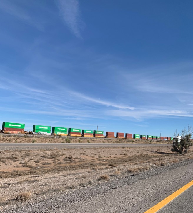
I’m now behind a Fed Ex double while a Union Pacific train hauling a bunch of double-stacked shipping containers heads back in the other direction. Not a terribly long train but nearly all the cars were stacked two-high.
Trees prevalent along the highway. I don’t know what kind but same as I saw in New Mexico, Quay County. Bark is distinct, a tortured ribbing. Kind of like Osage Orange. I meant to look at it last night because I’m armed with a tree field guide but instead I drank beer and watched the Golden Globes.
Sign announces Middlewater. But there’s nothing here. Drive on.
II. The Golden Globe.
The problem, Mr Phoenix, is not only how to stop eating beef bulgogi, pepperoni pizza, and patty melts. But also, I just drove through a desolate piece of the country. Beautiful but desolate. How do you now—next act—take away the animal agriculture industry? What does it mean if we all stop eating meat? What, then, is left of these places?
I really don’t know. Wind turbines. Tourism? Maybe, but even if people agreed (with me) that there was something to see here I don’t want them on those ranch land roads I was on today, where I could hop out and scout photos, even walk the dog. Where, while I was stopped taking photos of that sandstone creek bed, only one vehicle passed by in half an hour. Where I never felt unsafe. Where else do you get that?
And the Golden Globe for Best Drama goes to… 1917. Yeah, I’ve been watching the awards show. I’ve watched the whole damn thing. So what? I’ve seen none of the movies. And I’m in a tiled, pet friendly hotel room, #141, at the Best Western Discovery Inn in Tucumcari, NM. And now even the Golden Globes are over. Now what? Non-baseball sports highlights. That’s how desperate I am.
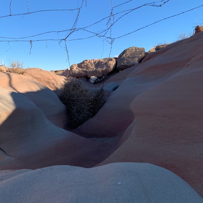
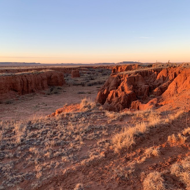
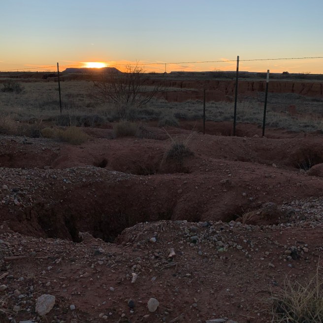
Canyon. What is a canyon, anyway? It’s where a river wanted to be that at some point it wasn’t, then was, and maybe still is, at least some of the time, at the very bottom.
III. Taiban to Quay: A Photo Essay.


IV. Billy The Kid Grave, Two Miles.
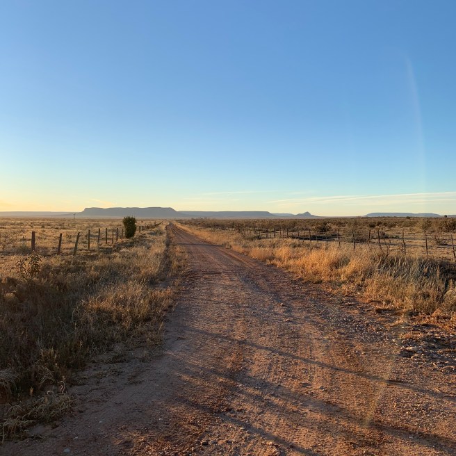
14:43. I’m closing in on my destination—Tucumcari—in a roundabout, backroad, backdoor sort of way. I’ve been hurtling east on NM 60, recently as fast as 90 miles an hour. But an easy 90 miles per hour.
After passing through Mountainair I saw a spot where I wanted to take photos so I stopped, even taking a moment to walk Hugo along the dirt road where I had pulled off of NM 60.


I later saw some salt flats, or maybe they weren’t salt flats but instead just “sometimes lakes” that were not full of water as I passed them. But they didn’t look to be completely dry, either. I took a photo of one of them.

Saints lost. That’s not the result I wanted but that game kept me company for hours, even being so kind as to go into overtime. I stopped briefly in Yeso for a photo of the old post office there.

Fort Sumner, elevation 4,060. Pecos River (wet). Tito’s Burritos. Closed? Coronado Motel. Rooms from $35/night. Next time! Rodeo Grill. Closed because it’s Sunday? Overall, Fort Sumner is alive and well. Not like Yeso, which was a deadspace except for two homes and that post office.
There was still a bunch of cholla cactus in the ranch land I went through on NM 60 east. Streets were named for, or to denote, the ranches they would lead you to. Or there’d be signs, painted on wood or stenciled out of metal, e.g. Luce Ranch, which I just passed. Earlier, Lucy Ranch.
Plenty more old-style windmills. One or two more trains, the tracks of BNSF and NM 60 running parallel. Lots of “new” windmills too. Wind turbines. The enormous white, new-age windmills, for power.
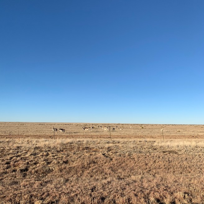
Mesa View Ranch. Two grey horses. I’ve got a car hot on my tail, which I haven’t had the displeasure of the whole time I’ve been on NM 60 east, going all the way back to the interstate, hours ago. Seen several Wal-Mart trucks. Also lots of bright white and orange… deer? Antelope? Ibex?
Just through Taiban I hang a left for NM 252 north. We took this on our trip out to Arizona. Incredibly, I’m just about to kick this notebook. The light’s starting to get that golden edge to it. A few mesas here—a few buttes. A red clay-banked creek bed. It’s beautiful through here. Special. The light is conjuring a critical luminosity. A numinosity. Stopping for a photo.
V. New Mexico, 60 East
Near noon. I’ve exited Interstate 25 for NM Highway 60 east. The Saints just scored in their playoff game versus the Vikings, which I’ve got on AM 610. Over the Rio Grande again; it looked full and happy. A few small patches of snow here.
I’ve achieved some elevation. Shacks. Trailer homes dot this landscape. There is land and beauty here but, it would appear, not much in the way of monetary wealth. Horse. Telephone poles. Cholla visible in the fields. Anything else has been grazed down.
Tire fence. Hawk low over road, feet away. Lots of junk on these smattered home sites. Old vehicles. An old bus. Old, trashed RVs. What is not mountain is flat. Old, hollowed-out bus, looking like it was bombed.
Suddenly the motor homes are no longer around. There’s just nothing. Scrub and then mountains. Not even any cattle. CR 220. Cholla cacti, which the cows can’t eat. OK, now a congregation of cows. Train in the distance. More cows. Short, stumpy cedars.
Rising into hills. Yeah, these are definitely cedars. Cedars and cholla. I’m in the hills. Long ridge in distance. Red clay, dark green dots of cedars. I pull off, hit the flashers, get a photo.
Bridge over train tracks. Angus bulls for sale. Red Canyon Campground, National Forest. Wouldn’t be the worst. Summer destination? Red clay banks where a creek sometimes runneth. It’s 55° and sunny. Some of these red clay creek banks are five or six feet tall. I bet there is some good hiking around here.
Shit, I just ran over a squirrel. Damn. It was nearly clear across, then doubled back. Shit. Coyote roadkill. Old-style windmill. Railroad tracks. Abo. Vikings take the lead. Wood pile. I pass a truck. A clod of red earth falls from its back wheel well. Oppo driver gives me the hand-on-steering-wheel wave. Lots of cowboy hats on the pickup truck drivers through here.
Old windmill, this one spinning. Sign for firewood. Landfill sign. Fresh eggs. Mountainair, elevation 6,495. 7-11, gas station, diner. Another wave. Bank. Market/deli, cute little town. I stop, thinking of a photo, but what I want to shoot is facing north, getting no light. Not right.
VI. Wind Gusts Possible.
To Albuquerque, 162 miles. To Santa Fe, 222. Now an enormous… lake? Probably a reservoir, something dammed, to my right. The water for all of this agriculture, I presume. A bunch of trailer homes. A bevy of cars pass me. Brown sign indicating Gila Cliff Dwellings.
The snow-capped peaks I once thought were in the north I now realize lay to the west. A pickup truck with furniture in the back. Courtney Barnett, U2. “How long, to sing this song, how long?” Not long enough, man, not long enough.
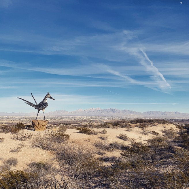
This is the chaparral. Pretty similar to where we camp east of Tijuana, toward Tecate. Prickly pear again. Elephant Butte Lake State Park. Truth or Consequences. I suppose— seeing how little is out here—this is why they tested a nuclear weapon here, before anywhere else.
A long, mountainous ridge to the west with snow all along it. Sierras? I should know but I don’t. Some cirrus out there now, maybe a little altocumulus. A newly visible mountain, its summit just touched with white. But I descend, and steeply! Houndmouth, Kurt Vile.
Bridge over a dry gully. Wind Gusts Possible, says the sign. A windsock, orange, flaccid today. The interstate curves and rises back up. Quite a snaking pass. Antenna array on top of a small building. Scaffolding red and white, tall, making a high, narrow goal, one of those microwave emitters on the top. I’ve seen a couple now. Communicating what? Ah, mysteries.
Another microwave array. Shorter, stouter, with a few of the convex discs—bowls on metal scaffolding. Flat through here now. I’m doing 85 without even thinking about it. Telephone lines run parallel. Dry creek bed. Three horses! Could they be wild? 371 miles into my return.
Nogal Canyon. Another limp windsock. I wanted to look left and right through that dip but I had cars near me and it was fleeting. Stark though, a narrow canyon. Smashing Pumpkins, Brasstronaut. The omnipresent, low bush, an orange-green—could be sagebrush. New snow-capped range to the east. These vistas are unreal.
Rest area next right. I’m gonna stop. Overflowing trash can, trash strewn about the ground. A man changing out another can.
Raven in a tree at this rest area. Overflowing garbage can changed out. A man with his two hijos speaking Spanish in the bathroom. They kept saying “aquí, aquí”.
I took Hugo for just a short walk and he stepped on some burr that embedded in his paw. I thought he was exaggerating but when I inspected, the burr came off and he was bleeding a bit where it had stuck him. Not such a good short walk. I tried to put a rubbing alcohol-soaked washcloth to the paw but he was growling at me. He’s licking at it. I’ll leave him be for now and get back on the road.
VII. Interstate Love Song.
January 5. With 268 miles on the trip odometer, I am heading east on I-10 again, bound for a ramp to I-25 North and away from Las Cruces.
Sneeze. No allergy pill yet today. Shuffling through my songs library. Beatles first, now Rolling Stones, “Out of Time”. But I ain’t out of time, I’m only just getting started. Flyover ramp. Sun. El Paso is only 42 miles from here, to the south-southeast, but I’m headed north. The only clouds are brief bits of contrail, way up. Bon Iver, “Team”. More Stones! I am amused because I had asked myself a question when “Out of Time” played. I was like, What if I just listened to the Rolling Stones for six hours?
The mountains of Las Cruces, which I think of as sawtoothed—their peaks topped with jagged rock that looks like baby teeth, fish teeth, like broken rock—are now in the rearview. Seventy-one miles to Truth or Consequences.
A billboard proclaims New Mexico the “chile capital of the world”. Speed limit 75. There aren’t too many people on this interstate. Rows of pistachio trees. Hills with contours, shadows, cliffs. Warm, brown, and beautiful. Time and water and wind and sun and the Earth’s upheaval. Halo Benders, Stevie Nicks.
I’ve had only the merest coffee. Radium Springs, next right. Come on in, the water’s fiiiiiine. Climbing. Twenty-two miles to Hatch. A hawk flies over the interstate, lands atop a utility pole. This is the best stretch of interstate I’ve driven in a long time, probably the best since going through Utah and Colorado with my brother.
Well, shit. Border Patrol inspection station. So much for that! I gotta exit. We all do. Never been through one of these before…
…Not much to that. Seconds. A flash as I drove toward the booth. My picture taken, I assume. Then a stop sign and a booth. Armed guard, looked like a baseball player—Jake Odorizzi.
“Have a good day, thank you.”
That’s all he said. Old-style windmill in the middle of an otherwise empty field. New Mexico might be the old-style windmill capital of the world, too. Windmills, chiles, pistachios, and nuclear physics.
Descending now, mountains in the distance, snow-capped. Dry wash. More pistachios, a dust dervish spinning through the rows of small-to-medium sized trees. A low, green plot of something. Bright green, pistachio green. Spinach? Pepper plants? Cross in median. A pickup passes, its bed full of the stuff of moving. A kid’s pink bike. Clothes crammed into black plastic garbage bags.
Exit to Hatch. Painted chiles on the overpass. Pistachios in the valley. Plateau. Cliffs catching a.m. light. More Beatles. This interstate is rolling. Scrubby slopes. Sparse bits of tumbleweed grass. Desert juniper. Greasewood. Scraggly trees I want to call creosote. It’s dry. Rocky, gravelly. Yet there continue to be fields plotted out, watered, farmed in the valley to the west.
Rectangle after rectangle of some low, green crop. And yet more of what I am learning are nearly ubiquitous in southern New Mexico: pistachio trees. Rising. No cactus anymore. Not even prickly pear. There’s an ocotillo and, way up above it, flapping black and white, a dozen or so snow geese.
A cow pasture and some prickly pear. An explosion of trees. Crossing a river… the Rio Grande! For me, it’s that easy. Plenty of water in it. It looks much different here than when you cross it west of Las Cruces. Rising again.
VIII. Pistachios, Probably.
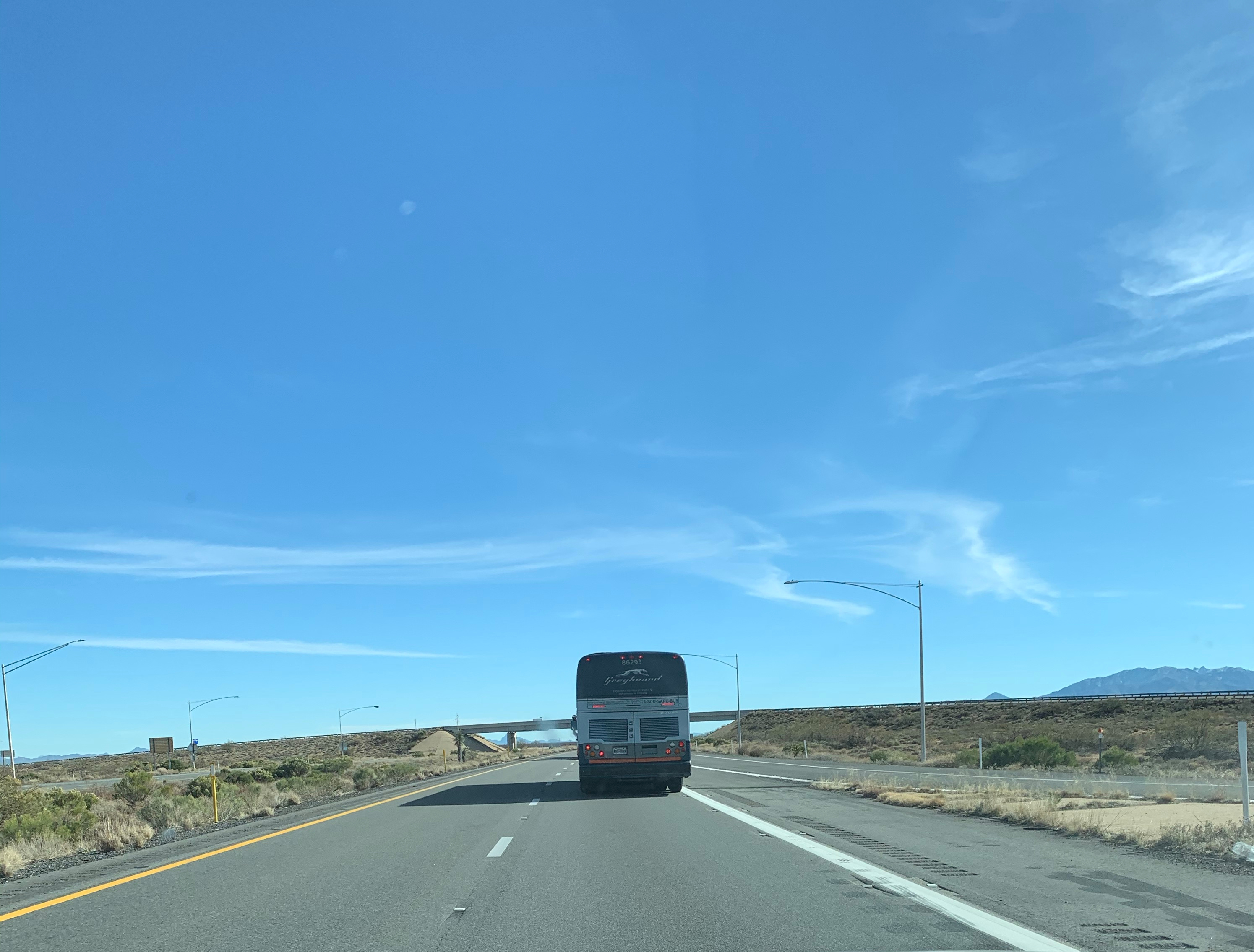
12:38. Blowing dust area. Some snow-capped peaks in the distance—what must be eastern, southeastern Arizona. Apache Pass Rd. Following behind a Greyhound bus. It’s been doing between 72 and 78 m.p.h.
Orchard. Rows of trees. Pistachios, probably. A younger grove of the same trees in the next field. Red-tailed hawk circling. I’m at nearly 100 miles away from the airport. Chris asked me how many miles we had driven on our way out to Tucson, from St. Louis. I didn’t know. Even my ballpark guess was wildly incorrect. It’s like square footage for houses. I have no sense of square footage for houses and I never will. But I’m keeping track of how many miles I travel on my way back to eastern Missouri.
Sporer did a good solo cast, signed off with talk of Julio Teheran. Next up: the CBS Fantasy Baseball podcast. They’ll talk about all of the same stuff and that’ll be fine. Greyhound making a pass! I hammer the left arrow down and pursue.
At 124 miles, New Mexico.
But nothing really changes. A slow-moving train spans the two states. At 138 miles, I go to music. First song is Belle and Sebastian, “The Boy with the Arab Strap”. I remember hearing this song for the first time. I was in college, hanging out with Taylor Upchurch, in his apartment at the corner of Big Bend and Forsyth. Funny, I sent him an email this morning, letting him know I was leaving the fantasy baseball league I’ve been in with him for over a decade. I’m ambivalent, a little sad, but it was time.
At 176 miles, the Continental Divide (4,585 feet). A border patrol agent slowly driving along an adjacent access road, looking for something—or someone. Jack Rose is humming and I’m going 80 in a whisper. Train!
Luna, county line. Quincy, one mile. Shuffle calls on Fakear, “Jonnhae Part 2”. Road endorphins kicking in. Just a little high cirrus, contrails like shed snake skins slowly dissolving in the light blue sky.
IX. What Is a Canyon Anyway?
Interstate 10 headed east. Just me and Hugo. Maybe I’ll look back and see that this wasn’t so bad. But I feel a grimness now. Paul Sporer, he of the fantasy baseball podcast, is my conversation mate for the next hour.
I’m drafting a semi at 70 m.p.h., cruising through highway-cut Arizona scrub hills. Davidson Canyon. What is a canyon anyway? Spindly ocotillos like whiskers on the hillsides. They’re very pretty whilst flowering. Now, they are interesting only in silhouette. Mesquite and prickly pear. Creosote bushes? Desert juniper.
We are getting passed by every vehicle. By one of those semi trucks hauling cars—eight cars. And weaving. Mountains in the distance. Tucson seems surrounded by mountains. I saw Mount Lemmon in the rearview as I left the airport, left B there, melancholia. The sense of an ending. Cienega Creek. Yucca. Pickup hauling a trailer: ATV and dirt bike. Mile-marker 290.
Days ago, I imagined visiting the What-A-Burger in Las Cruces, New Mexico—my intended stopping point today. But I carry sandwich goods. Half an enormous turkey sandwich from Beyond Bread called “Joel’s Jolt” sits in the passenger seat. In a fully packed cooler is a whole “Betty’s Brie”, a roast beef sandwich from the same place.
Besides the sandwiches, I have: four hard-boiled eggs that B made; some cheese, leftover yet from the drive out here; beer; a package of lox (courtesy Karin, my mother-in-law); a mess of granola bars (also courtesy Karin); some snack-y granola and pumpkin seed bites (Karin); and, a package of cranberry-almond-cashew mix (Karin). Oh, and a shepherd’s pie (Karin). There’s also some oat milk in an old Jack Daniels hip-flask. At the Drury in Las Cruces tonight, I can get some salad. Tomorrow morning I’ll eat biscuits and gravy.
Now, a major slowdown. Entering Cochise County.
X. The Trail Less Traveled.
January 1, 2020. 4:30 a.m. This is, without a doubt, the best I’ve felt on the first day of a new year since I developed my taste for alcohol, back somewhere in college, around the beginning of the century, some two decades now.
To feel this good in a new year is not without compromise considering I slept through—or planned away—the opportunity to ring in the new year with friends, with family. Here in Tucson, B’s family presumably watched fireworks and reveled past midnight with wine and smokes. I had gone to bed early. In part I was intrigued by the idea of going to bed early on New Year’s Eve. But more so I think I was worn out from a grueling hike we had gone on yesterday afternoon, through Ventana Canyon. The trailhead is not at all far from where my in-laws live, especially not as the crow flies.
We had been invited to the hike by B’s cousin, Chris. He drove to the trailhead separately, along with his wife and his two young adult sons. Right from the start, they were moving much faster on the trail than we were, which wasn’t a surprise. We had been zig-zagging back and forth across a pretty, peaceful mountain stream as it ran downhill and we churned upward. After the seventh creek crossing, a fellow hiker—he in the midst of his descent—informed us, “It gets steeper from here, then it flattens out, then you actually start going downhill, and that’s where The Pools are.”
Ah yes, The Pools. They were the ultimate destination, something like three miles by foot from the trailhead. Well, spoiler alert, we never made it to The Pools but it didn’t even matter. Here’s why.
Not long after we received the intel, we made a left turn that took us off the designated path and fated us to scramble up a steep hillside where at times there wasn’t much to hold onto—to steady ourselves—because most of the vegetation was one form of cactus or another (there was lots of staghorn cholla and prickly pear along with a few saguaro).
I have to give B credit because not long after we’d taken the left-hand turn that sent us on a rogue scramble up the hillside—and we weren’t the only people to make this mistake, not hardly—she turned back to me and asked very clearly, “Is this right?”
Being of soundly stubborn mind—and nurturing the idea that, although we had unwittingly agreed to this difficult hike, we should be up for the challenge nonetheless—I prodded us ahead. She observed that there no longer seemed to be many footprints. She had a point. The path had certainly narrowed, but I could see that at least some other people had traveled it before us, even recently.
The footing wasn’t good. The spur we had wandered onto wasn’t “trailed up” in any way. There were no steps, natural or manmade. We were like goats or sheep slowly grinding our way upward, at times shimmying up a slant between two opposing cacti. But, slowly, we were making a go of it. We were progressing up the hillside, mountainside, escarpment, embankment—call it what ye will. We were high enough up that I began to think ill whence looking down. As in, Man, if I slip, the only thing that’s gonna save me from going all the way back down to creek-level is a network of needled cacti.
We passed a lady who had lost herself up the same rogue spur as us. She was sitting at a rare, slightly level stopping place. We saw her again later, once we were “back down”. I don’t think she ever made it up to what was—for us—the top, a sort of ridge-summit that stood out from below but which was by no means the top of whatever mountain we were working into. This lady had come back down the hard way, and turned to show us her backside. This was my other fear as we chugged higher: even if we could get up to that ridge line, coming back down was still going to be really unpleasant, even dangerous.
Another hiker, a guy in a black shirt and black shorts carrying poles in each hand, had come past us on his way down. He didn’t say anything. He must have changed his mind after passing us on his way down because not much later, there he was, passing us again, this time making what must have been his second attempt to get up to the ridge on this tricky, unofficial path. He slipped on the scree at one point and must have reflexively clasped the needled hand of a cactus. He stopped for a minute to try and get some needles out of his hand. Then he said, to no one in particular, “I’ll just have to get them out later.” We never saw him again after that.
He forged ahead, leaving us mired in our own slog. B was not sure she wanted to go up any higher, any farther. We were both wondering how we had gotten ourselves into this. Up high on a steep hillside, slowly picking our way higher on loose rock while being surrounded by needle-minded cacti. If nothing else, our feet were starting to hurt. That kind of hiking puts a lot of stress on the big toes, on the balls of the feet.
Maybe it was pride. I didn’t want to appear weak to B’s cousin and his family, who, for all we knew, had easily moved up this same hillside and had long ago made it to The Pools, where they were now frolicking in the cool water with all the other in-shape hikers. Or maybe it was the fact that I could see we really weren’t that far from achieving some sort of summit that I suggested we finish what we started.
And we did. We got up there. Shortly before making the summit we noticed some other hikers comfortably waltzing along the ridge line, not seeming too concerned about having to make their way back down. A few minutes went by and they did not pass us. Where had they gone? It was as if they disappeared. Things were getting curiouser and curiouser.
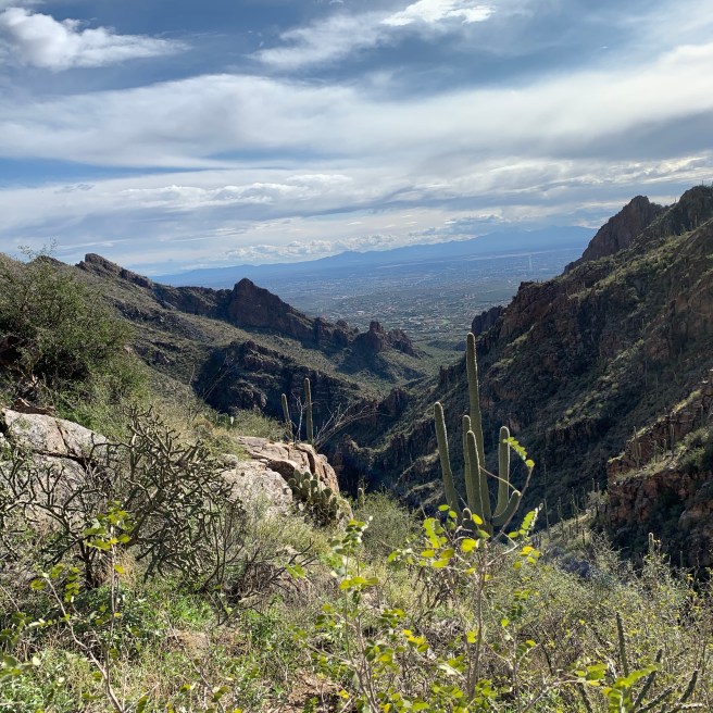
The view from up top was fantastic. We had gotten a strenuous workout. We split an apple, then an orange. Another couple of hikers came back from up ahead, presumably making their way back from what I now considered to be The “Infamous” Pools. We watched closely as they began their descent not by means of the route we had ascended but by way of a much more pronounced trail!
It was clear that we had goofed. Not long after that, Chris and his son Adrian appeared. The Pools were about a third of a mile that-a-way but they were, reportedly, nothing special.
“So, how did you guys make it up here?” Chris asked.
“We went the wrong way,” we said.
They had done the same thing. And it had been no easy task for them either. Adrian said something like, “That path was ridiculous.” This made us feel a lot better.
I finished off the dregs of some salty snack I had in my fanny pack and we went back down the mountain, this time using the designated, maintained, constructed path—one that had stair-steps built into it. What a hike.
We still had all the creek crossings to repeat and it was another three miles back to the trailhead, but after the slip-scree ascent our descent felt like a breeze. I’d do the hike again but, you know, as I sit here and think back on it, I wonder if, upon doing this hike again and taking instead the “correct” path, I might be left with the sense of a letdown. We—as Frost once wrote—we had taken the road less traveled by,
And that had made all the difference.
— MO/KS/OK/TX/NM/AZ,
December 2019-January 2020.
Discover more from JBR.com
Subscribe to get the latest posts sent to your email.
